Satellite NTN + Ground Stations
Monitor satellite beams, gateways, and coverage footprints alongside terrestrial assets — to keep service quality stable everywhere.
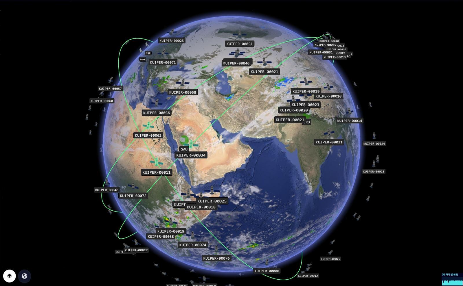
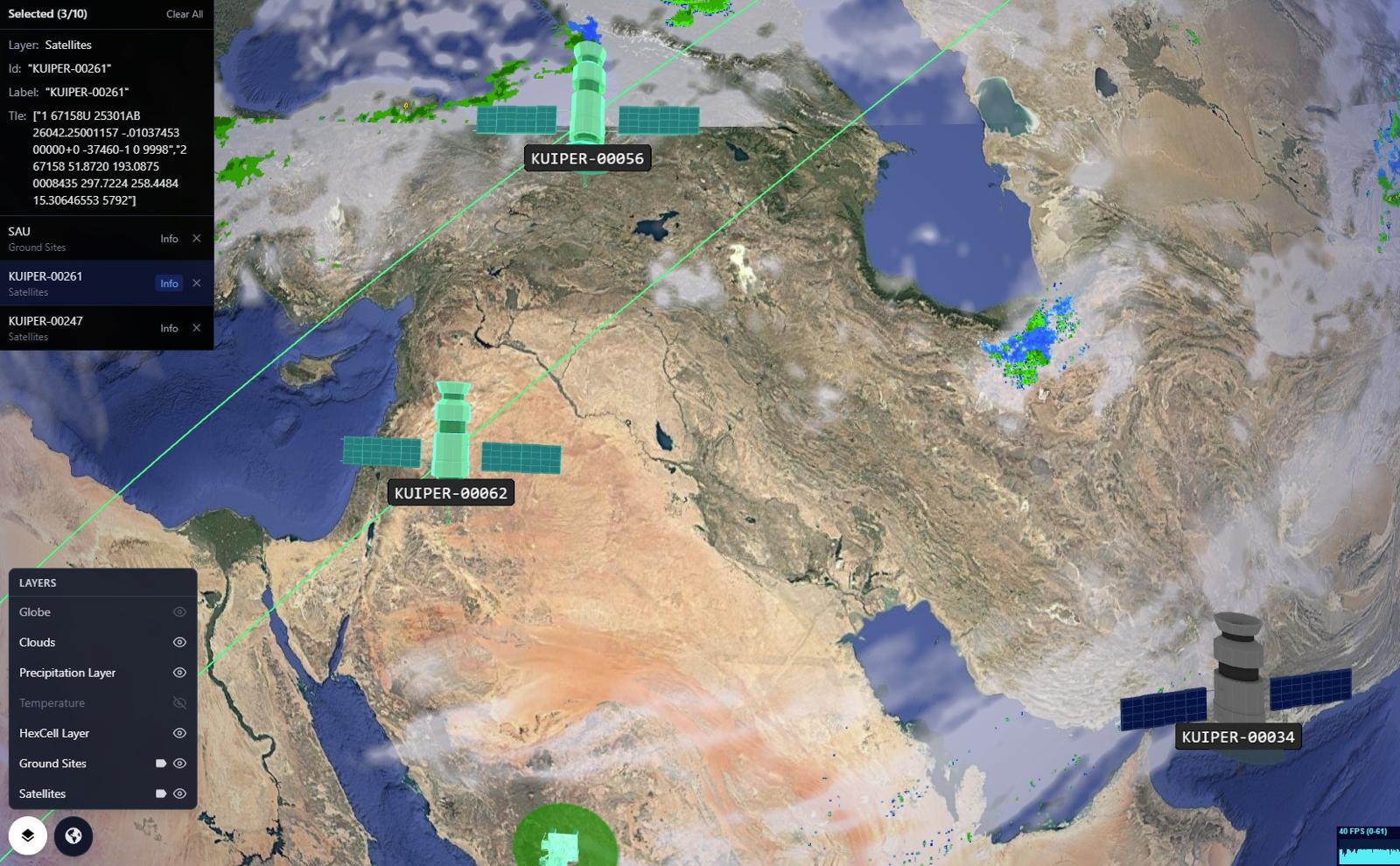
GRIP 3D brings satellite NTN operations onto a single live globe—constellations, ground stations, beam footprints, and service coverage in one view. Teams can overlay telco regions, roaming partners, and network KPIs to quickly spot coverage gaps, beam handover stress, and gateway issues. It’s built for NOC and engineering workflows: fast triage, spatial correlation, and time-based playback to validate “what changed” before customers feel it.
NOCs operate with fragmented satellite dashboards and flat maps. It’s hard to correlate a beam handoff, gateway degradation, or pass schedule with what customers experience on the ground.
- Coverage and beam data split across vendor portals
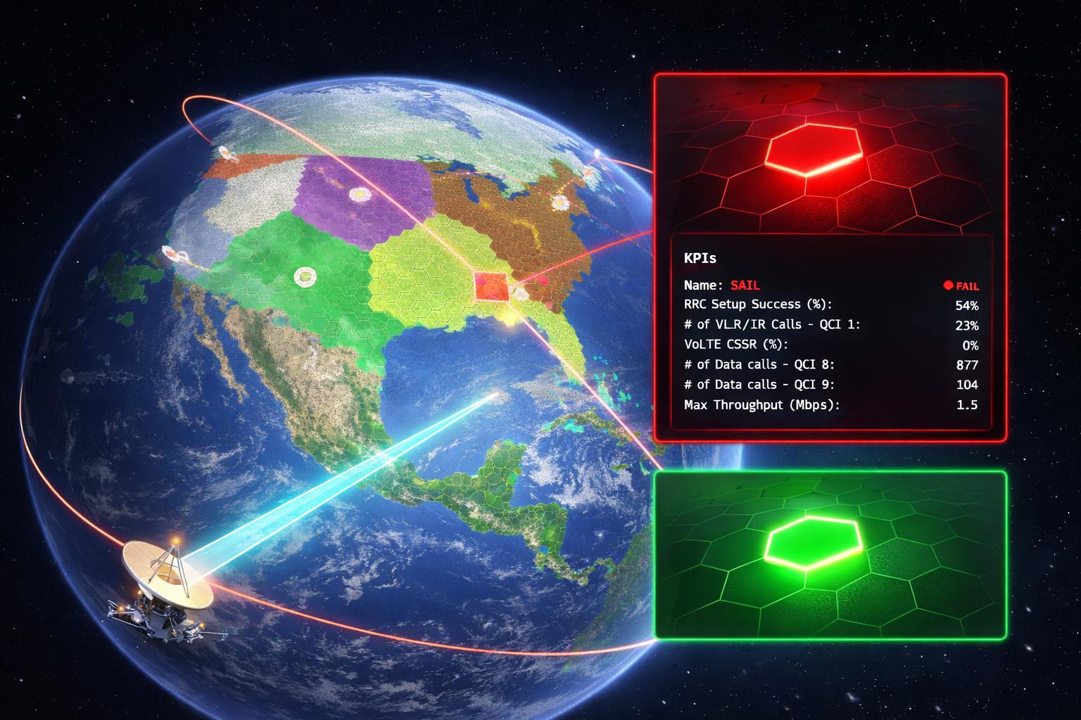
- No spatial link between satellite events and RAN KPIs
- Hard to explain impact to executives in 2D views
- Reactive troubleshooting after customers report issues
GRIP 3D renders constellation motion, beam footprints, and gateway health on a live globe — and correlates them with RAN / core / customer-impact layers for faster root cause.
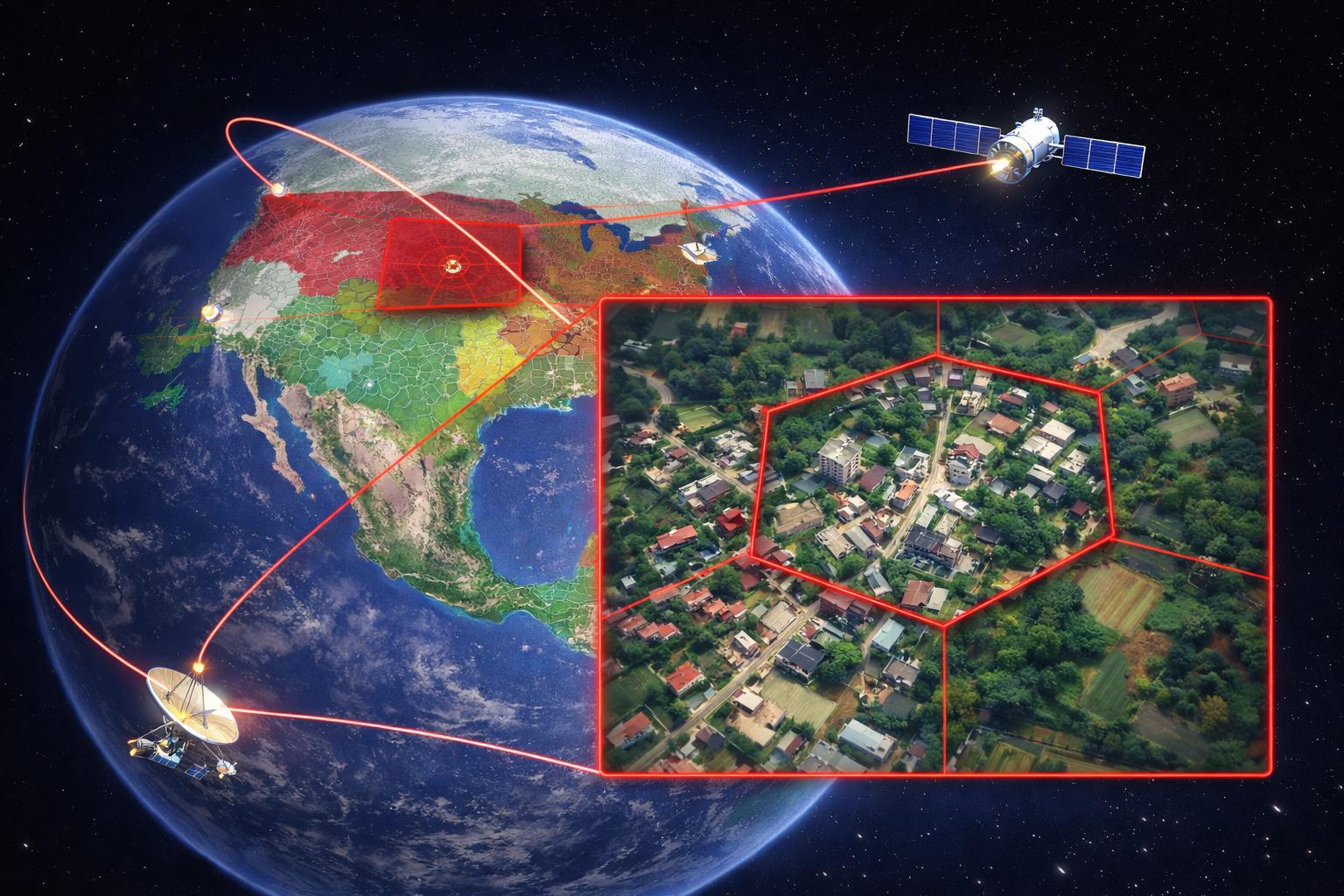
- Live beam footprint polygons with health coloring
- Gateways + ground stations mapped with status & SLAs
- Playback / time-travel of passes, handovers, outages
- Unified incident story: where, what, why, and impact
Why this works at enterprise scale
Capabilities
- Orbital tracks and pass prediction overlays
- Beam footprint coverage & handover visualization
- Ground station / gateway health with alerts
- Telco layers: sites, sectors, outages, customer-impact
- APIs for partner data ingestion and layer publishing
Platform Views
Open for consulting and partner integrations
If you want this use case mapped to your data sources, we can deliver a fast prototype and integration plan — including layers, APIs, and deployment options.